The latest Wellington weather signal for the India vs New Zealand second ODI is a regional Severe Thunderstorm Watch, not a washout call. The MetService Wellington watch covers noon to 6pm NZDT on Saturday 7 November. It describes a conditional risk across the southern North Island, not a prediction that severe weather will reach Hnry Stadium.
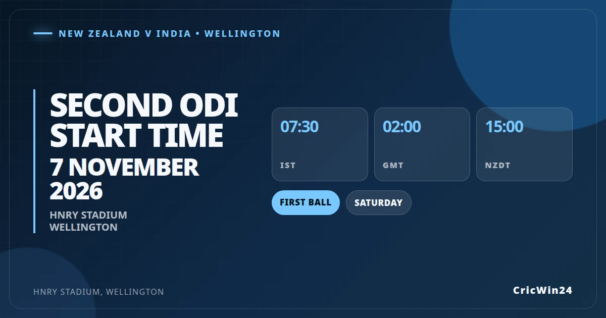
For readers in India, the expected toss is 07:00 IST (01:30 UTC / 14:30 NZDT) and the scheduled first ball is 07:30 IST (02:00 UTC / 15:00 NZDT).

Key takeaways
- Watch: The regional alert runs from noon to 6pm NZDT on Saturday and includes Wellington.
- Match timing: It covers the expected 14:30 NZDT toss and 15:00 NZDT first ball at Hnry Stadium.
- Point model: Wellington Kelburn shows 0.0, 0.4 and 1.1 mm/h at 15:00, 16:00 and 17:00 NZDT. These are hourly rainfall values, not rain probabilities.
| Timing | What the verified information says | Match-day risk |
|---|---|---|
| 12:00–18:00 NZDT, Saturday 7 November | MetService Severe Thunderstorm Watch; Wellington is a named area | Conditional regional risk of severe thunderstorms |
| 14:30 NZDT / 07:00 IST | Expected toss at Hnry Stadium | Toss falls inside the watch period |
| 15:00 NZDT / 07:30 IST | Scheduled first ball; Kelburn graph shows 0.0 mm/h at 15:00, 0.4 at 16:00 and 1.1 at 17:00 | Watch and point-model signals are not a guaranteed outcome |
What the MetService watch says
MetService issued the Severe Thunderstorm Watch at 20:57 NZDT (8:57pm) on Friday 6 November. It is valid for six hours, from noon to 6pm on Saturday 7 November. MetService says there is a moderate risk that thunderstorms may become severe around the southern half of the North Island during that period.
The hazard wording is conditional. If severe thunderstorms develop, MetService says they can produce localised downpours at 25–40 mm per hour. It also warns that rainfall of this intensity can cause surface or flash flooding and poor visibility. That rate is a potential severe-thunderstorm intensity, not an expected rainfall total at Hnry Stadium and not a forecast that the match will be washed out.
The next stated update is 11:00am NZDT on Saturday 7 November, the key checkpoint before the expected local toss. The alert identifies a wider risk area and time window; conditions at one ground still have to be assessed locally.
How the risk overlaps the match
The expected toss is around 14:30 NZDT, 30 minutes before the scheduled 15:00 NZDT first ball. Both checkpoints sit inside the watch window; its 6pm end does not promise that every risk or interruption will end then.
The equivalent India timings are 07:00 IST for the expected toss and 07:30 IST for the scheduled start on Saturday 7 November. The second-ODI timing guide separates the expected toss from the official scheduled start. Readers can also keep the detailed toss analysis open, but neither page confirms that a toss has happened before captains and officials announce it.
Why the watch and the point model can coexist
The same MetService Wellington page displays an hourly observations-and-forecast graph for Wellington Kelburn. In the match-time section, it shows 0.0 mm/h at 15:00, 0.4 mm/h at 16:00 and 1.1 mm/h at 17:00, followed by 0.0 mm/h at 18:00 and later displayed hours through the evening. These are rainfall rates, not percentages. The MetService hourly graph is a Kelburn point-model layer, not a stadium-specific forecast.
A regional watch and a lighter point-model sequence can coexist. The watch covers a wider area and a conditional severe-convection risk; the graph covers one location and time. Neither layer proves that play will be dry, interrupted or abandoned.
MetService cautions that hourly data can differ from written forecasts and icons, so the written watch leads this report while the Kelburn values are shown with their location and limits.
What remains unconfirmed
The captured official watch does not provide a reliable stadium-specific rain probability or guarantee an interruption. It cannot settle the toss, any inspection timing, the number of overs, a possible DLS calculation, or whether the match will be completed. Those are match-day decisions based on conditions and officials’ assessments.
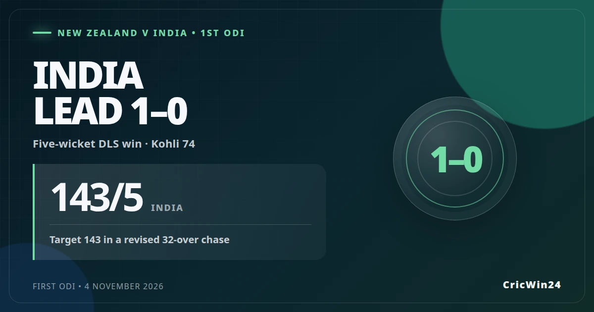
This update makes no claims about dew, drainage, runoff, pitch behaviour or an over-reduction. For venue context without turning it into a weather prediction, see the Hnry Stadium Wellington guide. For the series context, India lead 1–0 after the completed first ODI; the first-ODI result report covers that match separately. The forthcoming player-battles article is a selection-dependent tactical read, not a weather forecast or confirmed XI.
Quick FAQs
Does the watch mean the second ODI will be washed out?
No. It means MetService sees a conditional regional risk of severe thunderstorms during a six-hour period that includes Wellington. It does not say Hnry Stadium will receive severe weather, and it does not announce a washout.
What time does the watch overlap the match?
The watch runs from 12:00 to 18:00 NZDT. The expected toss is 14:30 NZDT and first ball is 15:00 NZDT. In India, those checkpoints are 07:00 and 07:30 IST.
Are 0.0, 0.4 and 1.1 mm/h rain probabilities?
No. They are the displayed hourly rainfall values for the Wellington/Kelburn point model at 3pm, 4pm and 5pm NZDT. They should not be converted into a probability or a promise of uninterrupted play.
When is the next official update?
MetService lists the next update for 11:00am NZDT on Saturday 7 November. That is the most useful scheduled checkpoint before the expected toss.
Bottom line
Wellington carries a genuine weather risk for the start of the second ODI because an official regional Severe Thunderstorm Watch overlaps the expected toss and early play. The alert is conditional, and the accompanying Kelburn graph is lighter. Monitor the 11am update and match-day decisions—not a premature washout call.
Source check: 6 November 2026 at 18:14 IST (7 November 2026 at 01:44 NZDT). Match times and venue references are aligned with the current schedule record.
Sources
- MetService Wellington Central 48-hour forecast and live watch
- MetService Severe Weather Outlook
- CricWin24 second-ODI timing guide
Editorial note: Prepared by CricWin24Editorial from the dated MetService material and retained fixture references above. Read our Editorial Policy for sourcing and correction standards.